East View Cemetery at East Lake
56 4th Ave SE, Atlanta, GA 30317
Managed by East View Cemetery Association, Inc., funded solely by your donations
Donate Now
Securely, via Paypal
Securely, via Paypal
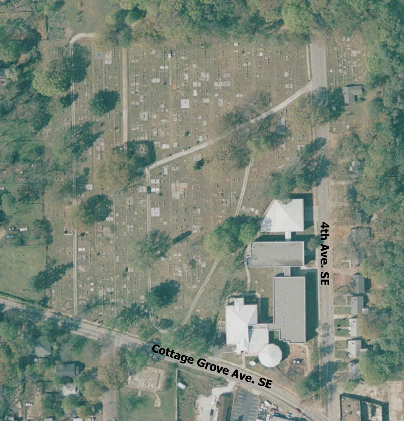
Aerial View and Layout
Aerial view of East View Cemetery (with street names added). Click to view a larger version.
Layout of the cemetery plots. Click to view a larger version. NOTE: This is the result of a survey performed in the 1940s. We have since discovered that some places that are marked as foot paths or sidewalks were later sold as plots. This layout (which is also posted on the outside of the office at the cemetery) gives a good idea of where a plot is located, but please feel free to check with us for the latest known information, or use the Locate A Grave tool.
